Which LiDAR Is Right For You?
LiDAR is a mainstay of non-destructive testing (NDT), allowing inspectors to quickly and easily build a 3D model from which the required information can be extracted.
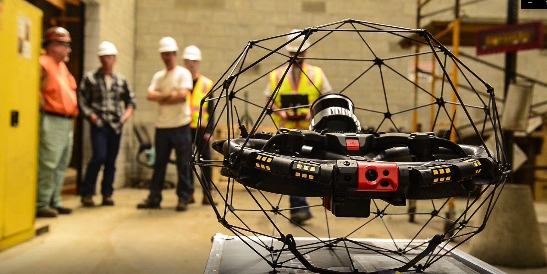
The Elios 3 – Flyability’s innovative cage drone – is the only such unmanned aerial vehicle in the world that carries LiDAR technology. Not only has it revolutionised inspection processes, but the company has already rolled out its second iteration of the technology. tech.
In quarter four of 2023, Flyability announced the new ‘Surveying Payload’ into the mix, providing inspectors with enhanced options for 3D surveys, confined space inspections and hard-to-access locations.
Standard vs. Surveying Payload
There are key differences between the two mapping capabilities. However, the new addition isn’t meant to replace the original – far from it. Instead, it provides enhanced benefits to upgrade particular surveying situations.
To understand which option is best suited to a task, it’s necessary to compare and understand the differences between the two.
These can briefly be described as:
- Standard payload: Consists of LiDAR sensor Ouster OSD-32 Rev 6.2 for data collection. This uses a powerful Simultaneous Localisation and Mapping (SLAM) algorithm to produce highly accurate and dense point clouds
- Surveying payload: The sensor is upgraded to an Ouster Oso-123 Rev 7. This utilises a FARO Connect SLAM software licence. The combination improves the overall surveying capabilities
These significant changes bring multiple surveying upgrades that can be defined in five separate categories.
- Accuracy: The overall accuracy of the new payload is improved up to 10 times
- Efficiency: Provides double the range and four times the point density
- Quality: Returns LiDAR data that’s 1.5 times more precise and photon sensitivity that’s increased tenfold
- Improved data within symmetrical settings: Better tolerance within such environments (such as pipes/wastewater tunnels/etc)
- Enhanced processing: The combination of the upgraded LiDAR with the software licence for FARO Connect streamlines and improves the processing options
While this is a highly simplified overview of the two options, having a rough understanding of how the technology upscales the processes helps to define which option is preferable for surveying needs. Selecting which to choose should be driven by the requirements of the task at hand.
The new surveying configuration is more advantageous when some or all of the following are applicable:
- Surveying that demands centimetre-level accuracy
- Challenging terrain and/or environments
- Surveying is needed in areas that are unsafe for humans to enter
- Where minimal tolerance for error is essential
- When speed is of the essence – the software is wholly equipped to return fast models and streamline workflows
The standard configuration is best used when:
- The 3D model is to be used to gain situational awareness and visual data
- LiDAR is used to navigate complex spaces and visualise defects
The Elios 3 offers unique inspection abilities and is just one example of how Nexxis works in partnership with innovative companies, like Flyability, to provide NDT equipment that solves complex inspection tasks. From off-the-shelf options to custom solutions and the latest robotic technology, our expert team will help to solve even the most challenging of testing needs.
Contact us to find out more learn more about our drone products or request a quote online.
